
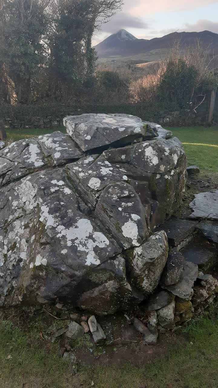
Twice a year, the setting sun rolls down the side of Croagh Patrick, seen from an ancient carved rock.

SIMULATED
Simulated from a 3D map of the land, not a photograph.
—
Our calculation from a 3D map of the land backs up what Gerry Bracken described: on 18 April and 24 August the setting sun hugs the upper north slope of Croagh Patrick, within about half a degree, for roughly 15 minutes. Kudos to Gerry Bracken, who described the setting sun rolling down the north side with P. A. Wayman in 1992.[1]
What is the Boheh Stone?
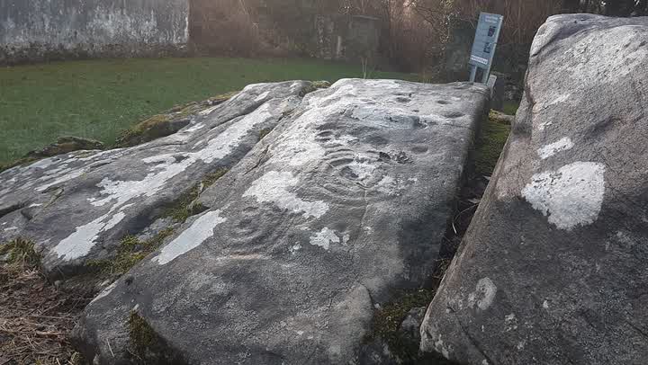
It is a national monument in Boheh townland, Co. Mayo: a large natural boulder with more than 250 prehistoric carvings, mostly cups, cup-and-rings and keyhole shapes. Local people, and the old Ordnance Survey maps, call it St Patrick's Chair and Knee Mark.[1]
A 1993 report for Mayo County Council places it 6.5 km south-south-west of Westport, on the pilgrim way from Ballintubber Abbey to Croagh Patrick.[2] The National Monuments Service says Gerry Bracken and P. A. Wayman, in 1992, described the setting sun rolling down the north side of Croagh Patrick on 18 April and 24 August.[1]
The Office of Public Works says the carvings are thought to date to about 3800 BC. It lists the place as unguided and asks visitors to take care, so check access locally.[3]
Where
The gold dot is the stone, at 53.747673° N, 9.554261° W.[1]
Outline: Natural Earth, public domain.
Sources
- National Monuments Service, record MA097-006001-. Historic Environment Viewer
- Excavations.ie, 1993:172. Report
- Heritage Ireland, Boheh rock art. Office of Public Works
- Wikipedia, Boheh Stone. A pointer only
What we did
- We took the rock's exact spot from the National Monuments Service.
- We used a 3D map of the land to draw the mountain's outline exactly as seen from the rock.
- We calculated where the sun sets every day of the year and checked the published dates.
Yes, on 18 April and 24 August the sun hugs the upper slope for about 15 minutes, then drops behind the lower ridge. It rolls down the top part, not all the way.
Best seen from the stone near Westport, Co. Mayo. Map
The science
Cruach Phádraig · Boheh Stone
The sun rolls down the upper slope, not the whole slope
From the Boheh Stone, the setting sun on 18 April and 24 August is said to roll down the north side of Croagh Patrick. In our calculation it hugs the upper north slope, within about half a degree, for roughly 15 minutes, then drops below the lower ridge. This drawing uses the shape we calculated. It is a simulation, not the sky outside.
Loading the calculated profile…